Route Mechanics & Grading
Find Your Footing
Visitors arriving in the Norwegian mountains from Central Europe or North America are frequently caught off guard by how trails are constructed—or rather, how rarely they are engineered. Outside a handful of heavily visited stone staircases built by Nepalese Sherpa masons to combat erosion on iconic coastal climbs, a Norwegian mountain path is simply a corridor worn into raw glacial topography, marked every fifty to two hundred metres by a splash of red paint on a cairn.
Understanding what lies beneath your boot soles is the single best safeguard against exhaustion and ankle injury. Before selecting a summit objective, break the route down into four physical variables: substrate friction, vertical profile geometry, hydrological obstacles, and escape options.
The Four-Tier National Grading Standard
In collaboration with Innovation Norway and regional outdoor councils, Den Norske Turistforening (DNT) classifies routes using four color-coded difficulty levels. Note that weather can temporarily elevate any route by one full grade when rain turns dry gneiss into a lubricated ramp.
- Green (Easy / Enkel): Short walks under 5 km with less than 200 metres of ascent on gravel tracks, forest paths, or stable boardwalks. Suitable for novices in sturdy low-cut trail shoes.
- Blue (Moderate / Middels): Routes up to 10–15 km with 300 to 600 metres of vertical gain. Expect uneven roots, boggy stretches, minor stream hops, and modest scree. Basic map competence required.
- Red (Demanding / Krevende): Full-day mountain traverses of 12 to 22 km with 600 to 1,100 metres of ascent. Includes sustained boulder fields (ur), steep unguarded ledges, snowpatch crossings, and wading cold meltwater.
- Black (Expert / Ekspert): Long, steep alpine undertakings exceeding 1,000 metres of vertical gain, narrow scrambling ridges requiring hands for balance, complex routefinding in mist, and zero trail infrastructure.
| Route & Region |
DNT Grade |
Distance / Ascent |
Dominant Underfoot Substrate |
Primary Exposure Factor |
| Besseggen Ridge (Jotunheimen) |
Red (Demanding) |
14.2 km / +1,100m |
Gabbro bedrock steps, loose moraine gravel |
Hands-on-rock scramble on exposed narrow spine; wind tunnel effect |
| Rondslottet via Vinjeronden (Rondane) |
Black (Expert) |
19.5 km / +1,080m |
Angular quartzite talus and frost-shattered blockfield |
6 km of continuous boulder hopping above 1,600m; high ankle strain |
| Romsdalseggen Traverse (Rauma) |
Red (Demanding) |
10.3 km / +970m |
Gneiss slabs, narrow airy crest, stone steps |
Steep drop-offs toward Romsdalen; fixed chains on damp rock sections |
| Gaustatoppen from Stavsro (Telemark) |
Blue/Red |
8.6 km / +710m |
pitched stone steps transitioning to coarse talus |
Rapid coastal cloud buildup; icy rock crevices late in season |
| Kjerag Plateau (Lysefjorden) |
Red (Demanding) |
11.0 km / +800m |
Glacially polished granite slabs and chain pulls |
Three steep ascents/descents on smooth rock; extremely slick in rain |
| Finse to Krækkja (Hardangervidda) |
Blue (Moderate) |
23.0 km / +420m |
Peat bog, glacial till, late-summer snowfields |
Flat horizon whiteout navigation; high windchill with zero tree cover |
Reading Substrate: Scree, Slabs, and Peat
Three distinct ground surfaces dominate Norwegian mountain reports, each demanding a different biomechanical cadence:
1. Blockfields and Talus (Steinur)
Above 1,300 metres in ranges like Rondane, Dovrefjell, and Reinheimen, bedrock has been fractured by millennia of freeze-thaw cycles into vast seas of angular stone. Walking across ur requires scanning two to three steps ahead rather than staring at your toes. Step onto the center of flat-topped blocks rather than wedging your boot into dark gaps between rocks. Notice the lichen color: black crustose and green map lichen (Rhizocarpon geographicum) become treacherously soapy within three minutes of light drizzle. On wet lichen, keep your center of mass directly perpendicular to the rock surface rather than relying on edge friction.
2. Glacially Polished Slabs (Svaberg)
Western fjord ranges from Ryfylke to Sunnmøre and Lofoten are carved from ancient Precambrian gneiss and granite smoothed by receding ice sheets. When bone-dry, svaberg offers remarkable grip for high-friction rubber soles. When damp or covered in a thin film of black algae from snowmelt seepage, those same slabs turn into chutes. Always look for pale quartz veins or unpolished fracture cracks to place your boot edges during descent.
3. Saturated Mire and Tussock Bog (Myr)
Valley approaches and sub-alpine birch forests act as giant sponges. Where timber duckboards (klopper) are absent, skirt the perimeter of bright green sphagnum moss carpets—bright neon green indicates deep, floating water saturation. Aim instead for brownish sedge tussocks or dwarf willow roots, which possess an interwoven root mat capable of supporting a hiker's weight.
"Never judge a river crossing at 08:00 and assume the same ford will welcome you back at 17:00. Warm afternoon sun on high glaciers doubles discharge volume in unbridged valleys."
Field Note 11 — Veodalen Hydrological Log
River Wading Protocol (Vading)
Even on marked trails, early-season snowmelt or autumn bridge removal forces hikers to wade glacial streams. Never wade barefoot: sharp glacial cobbles and numbing 2°C water cause instant loss of balance. Remove your wool socks and insoles, put your boots back on over bare feet (or wear dedicated lightweight camp sandals with heel straps), unbuckle your rucksack hip belt and sternum strap so you can jettison the pack if swept off balance, and cross diagonally downstream using trekking poles for three points of contact.
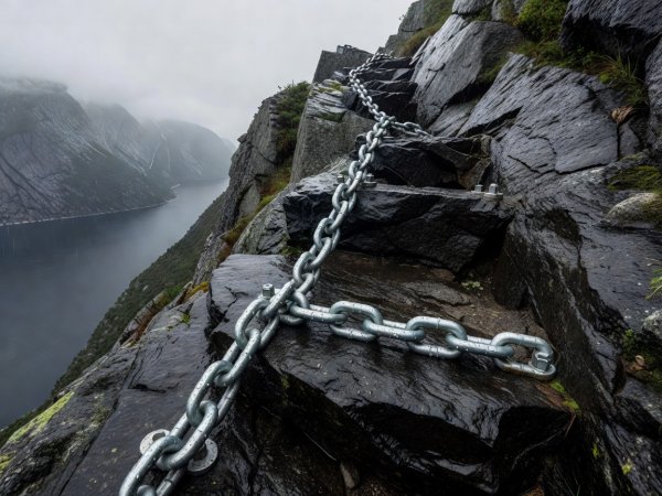 Slab Friction
Western Fjords • Granite & Gneiss
Fixed Chains & Polished Ramps
Treat fixed steel chains as balance aids rather than haul lines; keep boot soles flat against dry crystal grain to maximize rubber contact area.
Check Footwear Specs
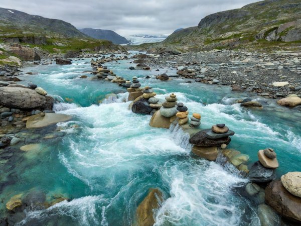 Hydrology
High Valleys • Meltwater Cycles
Reading Braided Channels
Cross where a single turbulent chute splits into three or four wider gravel braids; wider channels reduce water depth below knee height, cutting hydrodynamic force in half.
Bridge Season Dates
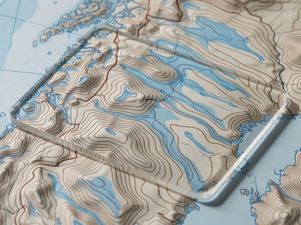 Cartography
1:50,000 Standard • 20m Contours
Decoding Contour Compression
On Norwegian N50 maps, a 20-metre contour interval means five lines packed into two millimetres equals a 45-degree slope requiring careful route micro-navigation.
Explore Summit Sightlines